Snap & Map: Instant GIS for Permaculture Design
By Permaculture Institute of North America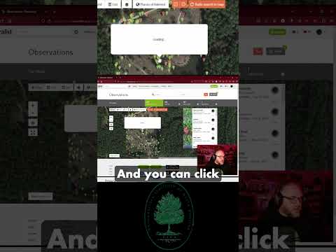
TL;DR: A new smartphone tool simplifies landscape mapping for permaculture design and ecological restoration by using geotagged photos to create detailed, interactive maps.
- New tool simplifies land mapping with smartphone photos.
- Automatically stitches images onto satellite views.
- Leverages GPS data for accurate photo placement.
- Accessible, user-friendly, no specialized equipment needed.
- Allows annotations for plant, soil, water data.
Why it matters: This technology democratizes detailed land analysis, making advanced mapping accessible to anyone with a smartphone, which can significantly improve permaculture planning and ecological restoration outcomes.
Do this next: Explore existing smartphone apps that offer geotagged photo mapping features for your next site analysis.
Recommended for: Anyone involved in land assessment, permaculture design, or ecological restoration who wants an efficient and accessible way to map their site.
A new mapping tool is emerging that simplifies the process of documenting and analyzing land features, particularly beneficial for permaculture design and ecological restoration projects. This innovative application allows users to create detailed maps simply by taking photographs as they walk through a landscape. The core functionality revolves around its ability to automatically stitch together these images and overlay them onto a satellite or aerial view of the area, providing a comprehensive visual representation.
The tool operates by leveraging the GPS data embedded in smartphone photographs. As a user captures images, the application records the precise location and orientation of each shot. This spatial information is then used to accurately position the photographs on a base map. The result is a dynamic and interactive map where each photograph acts as a data point, offering a ground-level perspective of the features being documented. This method significantly reduces the time and effort traditionally associated with manual surveying and mapping techniques.
One of the key advantages of this technology is its accessibility. Designed to run on standard smartphones, it eliminates the need for specialized and often expensive mapping equipment. This democratizes the mapping process, making it available to a wider range of individuals and organizations, including small-scale farmers, community groups, and educational institutions. The user-friendly interface is intuitive, allowing individuals with minimal technical expertise to quickly learn and utilize its features effectively.
Beyond simple photo placement, the tool offers advanced functionalities that enhance its utility for permaculture practitioners. Users can add annotations, notes, and specific data points to each photograph or location on the map. This allows for the recording of crucial information such as plant species identification, soil conditions, water flow patterns, existing infrastructure, and potential design elements. This rich layering of data transforms a collection of images into a powerful analytical tool, aiding in the identification of patterns, problems, and opportunities within a given landscape.
The application also facilitates collaboration and sharing. Maps created with the tool can be easily shared with others, enabling teams to work together on design projects, monitor progress, and communicate findings effectively. This collaborative aspect is particularly valuable for permaculture, which often involves community participation and the integration of diverse perspectives. Shared maps can serve as a central repository of information, fostering a common understanding of the landscape and guiding collective decision-making.
Furthermore, the tool supports the creation of various map layers. Users can categorize their photographs and annotations into different themes, such as water management, access routes, planting zones, or existing vegetation. This layering capability allows for a more organized and detailed analysis of the landscape, making it easier to visualize different aspects of a permaculture design. For instance, one layer might show all existing water sources and pathways, while another might highlight areas suitable for specific plant guilds.
The potential applications extend beyond initial design. The tool can be used for ongoing monitoring and evaluation of permaculture systems. By taking periodic photographs of the same areas, users can track changes over time, observe the growth of plants, assess the effectiveness of interventions, and document the evolution of the landscape. This longitudinal data is invaluable for adaptive management and for refining permaculture strategies based on real-world observations.
In essence, this mapping tool represents a significant advancement in how permaculture designers and land stewards interact with and understand their environments. By integrating photography, GPS technology, and intuitive data management, it provides an efficient, accessible, and comprehensive solution for mapping, analyzing, and designing sustainable land systems. Its ability to capture ground-level detail and integrate it with broader aerial perspectives offers a holistic view, empowering users to make more informed and effective decisions in their permaculture endeavors.