Digital Permaculture Summit: Tools Pros Use for Design
By Permaculture Institute of North America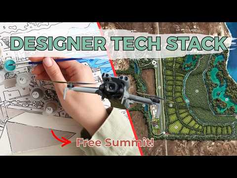
PermaNews Brief
Key Takeaways
Digital tools like GIS and CAD are revolutionizing permaculture design, enabling precise site analysis and planning.
- GIS maps topography, soil, water flow, and sun paths.
- Satellite and drone data enhance site assessment accuracy.
- CAD software creates precise design layouts and 3D models.
- Digital methods improve client communication and project management.
- Open-source options like QGIS are readily available.
Why It Matters
Adopting digital tools can significantly improve the efficiency, accuracy, and resilience of permaculture designs, leading to better outcomes for both designers and their clients.
What to Do Next
Explore open-source GIS software like QGIS to understand its capabilities for site analysis.
Recommended for: Permaculture designers and enthusiasts interested in leveraging technology for improved design accuracy and efficiency.
The Digital Permaculture Designers Summit, hosted by the Permaculture Institute of North America, brought together professionals to discuss and demonstrate the digital tools and strategies they employ in their permaculture design practices. The summit highlighted a range of software, platforms, and methodologies that are transforming how permaculture designers approach site analysis, design, client communication, and project management.
A significant portion of the discussions revolved around Geographic Information Systems (GIS) software. Designers showcased how they utilize GIS tools like QGIS (an open-source option) and ArcGIS to gather, analyze, and visualize spatial data. This includes mapping topography, soil types, water flow, sun paths, existing vegetation, and infrastructure. The ability to layer various data sets allows for a comprehensive understanding of a site's characteristics, informing more effective and resilient design solutions. For instance, participants demonstrated how to import elevation data to create contour maps, analyze slope aspects for optimal plant placement, and model water catchment systems.
Beyond basic mapping, the summit delved into more advanced applications of GIS, such as using satellite imagery and drone data for detailed site assessments. These technologies provide high-resolution visual information that can be integrated into design plans, offering a more accurate representation of the site and its potential. The use of these tools also facilitates the identification of microclimates and specific ecological niches that might otherwise be overlooked.
Another key theme was the integration of Computer-Aided Design (CAD) software, such as AutoCAD or SketchUp, for creating detailed design layouts and 3D models. Designers explained how CAD allows them to translate their conceptual permaculture designs into precise, measurable plans. This includes drawing out garden beds, food forests, earthworks, and irrigation systems with accuracy. The 3D modeling capabilities of some CAD programs were particularly emphasized, as they enable designers to visualize the proposed changes in a realistic manner, helping clients better understand the design and its aesthetic impact. This visual clarity is crucial for effective client communication and securing buy-in for complex projects.
The summit also addressed the importance of project management and client communication tools. Professionals shared their experiences with platforms like Asana, Trello, or even simpler spreadsheet-based systems for organizing tasks, tracking progress, and collaborating with clients and team members. The emphasis was on creating transparent and efficient workflows that ensure projects stay on track and client expectations are managed effectively. Some designers also highlighted the use of cloud-based platforms for sharing documents, design iterations, and feedback, streamlining the communication process.
Furthermore, the discussions touched upon the use of specialized software for specific permaculture applications. This included tools for calculating water budgets, analyzing energy flows, and even simulating plant growth and yield. While not universally adopted, these niche tools demonstrate the growing sophistication of digital permaculture design and the potential for data-driven decision-making.
The summit underscored the value of open-source software, particularly QGIS, due to its accessibility and robust features. Many designers expressed a preference for open-source solutions, aligning with the permaculture ethos of sharing knowledge and resources. The collaborative nature of the open-source community also means continuous development and improvement of these tools.
Overall, the Digital Permaculture Designers Summit painted a picture of a profession increasingly embracing technology to enhance efficiency, accuracy, and communication. The tools discussed, ranging from GIS and CAD to project management platforms, are empowering permaculture designers to create more sophisticated, data-informed, and visually compelling designs, ultimately contributing to the broader adoption and success of permaculture principles. The event highlighted a clear trend towards integrating digital solutions into every stage of the permaculture design process, from initial site analysis to final client presentation and project implementation.
Source: youtube.com
Related Analysis
- Universities Launch Farmer-to-Farmer Skill Shares on Zoom — A new online skill-share series co-hosted by CSU and Agraria Center signals nascent institutional interest in peer-to-pe…
- City Renters Quit Leases to Build Off-Grid From Scratch — Early signals from two documented cases suggest urban renters are leaving city leases to build off-grid homesteads, citi…
Explore more in Skills, Preparedness & Self-Reliance — the full hub for this knowledge area.